Myanmar Quake Reveals Secrets of Mature Faults
A momentous earthquake that shook Myanmar on March 28, 2025, has provided scientists with a rare and valuable opportunity to study the behavior of some of the world's most formidable fault systems. The event occurred along a remarkably straight and geologically "mature" fault, creating an almost perfect natural laboratory for observing how a major continental earthquake releases its immense energy.
Unraveling the Shallow Slip Deficit Mystery
Typically, earthquakes are chaotic events that are difficult for scientists to analyze. However, the simplicity of the Myanmar earthquake's fault geometry eliminated many of the usual complexities, allowing for a clearer view of seismic energy transfer. An international team of researchers, spearheaded by The University of New Mexico, seized this opportunity to investigate the long-debated "shallow slip deficit." This phenomenon refers to the common observation that ground movement at the surface during an earthquake is often significantly less than the slip that occurs deep below. Scientists have questioned whether this missing energy is absorbed by surrounding rock formations or simply remains unaccounted for.
The team's research, detailed in the Nature Communications study "Mature fault mechanics revealed by the highly efficient 2025 Mandalay earthquake," sought to understand how energy propagates along an ancient, simple fault and to determine if motion from deep within the Earth is fully expressed at the surface.
Studying a Cataclysm from Orbit
Due to ongoing armed conflict and infrastructure damage in Myanmar, immediate on-the-ground fieldwork was impossible. The research team pivoted to advanced satellite technologies to gather crucial data remotely. They employed two primary methods: Optical Image Correlation, which uses Sentinel-2 satellite images to track the displacement of pixels on the ground before and after the event, and Interferometric Synthetic Aperture Radar (InSAR). InSAR, utilizing Sentinel-1 satellites, precisely measures changes in the distance between the satellite and the ground across two separate passes. These techniques enabled the team to map ground shifts with extraordinary precision without entering the hazardous area.
The Power of InSAR Technology
InSAR operates by sending radar signals to the Earth's surface and analyzing the returning waves. By comparing the travel time of these signals from two different satellite passes, scientists can detect minute changes in ground elevation and position, accurate down to a fraction of an inch. This technology allows for the creation of detailed maps showing how the Earth's crust deformed over hundreds of square miles, functioning effectively day or night and even through cloud cover. This powerful tool gave the researchers a comprehensive and highly accurate picture of the earthquake's impact.
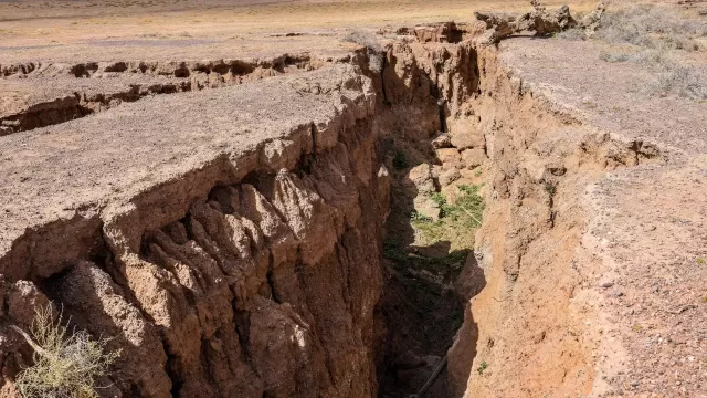
An Epic 500-Kilometer Rupture
The earthquake's rupture was immense, extending for nearly 500 kilometers. This is comparable to a fissure running from Albuquerque to Denver, with the land on either side shifting by as much as 10 to 15 feet. Most earthquakes studied by scientists involve much shorter fault breaks, typically 30 to 60 miles long. The observation of such a long, continuous, and straight rupture represents an exceptionally rare and scientifically important event.
A Fault System Like California's San Andreas
The event occurred on the Sagaing Fault, a strike-slip fault where tectonic plates slide horizontally past one another. This is the same type of fault as the famous San Andreas in California. The Sagaing Fault is also described as "mature," meaning it has been active for millions of years. Over this vast geological timescale, the fault has been worn down, smoothing out its rough edges and curves. This smoothness allowed the earthquake's rupture to travel with remarkable efficiency across such a vast distance with minimal resistance.
Complete Energy Transfer to the Surface
A key finding of the study was the complete absence of the shallow slip deficit. The researchers discovered that the massive amount of slip that occurred miles beneath the surface was transferred with 100% efficiency to the ground level. This stands in stark contrast to many other recent earthquakes where energy was dispersed through a complex network of smaller fractures, reducing the motion seen at the surface. This result suggests that on mature, smooth faults, seismic energy is highly concentrated and delivered directly to the surface, potentially leading to more intense ground shaking near the fault line than current hazard models predict.
Linking Faults and Predicting Motion
The research also showed that the single rupture was able to connect several distinct fault sections, breaking through boundaries that might have been expected to stop it. The team noted that the fault's behavior followed a historical pattern known as "slip predictability." Segments that had experienced earthquakes more recently in the 20th century slipped less, while areas that had been dormant since the 1800s experienced the most significant movement. This insight could enhance long-term earthquake forecasting by allowing scientists to estimate the potential slip on fault segments that have not ruptured in a long time.
The Global Impact of Satellite Science
This study highlights the growing importance of satellite observation in understanding natural hazards. Even in an inaccessible conflict zone, scientists were able to conduct one of the most detailed analyses of earthquake mechanics ever performed. This achievement underscores how international scientific collaboration and open-access data, such as that from the Copernicus Sentinel missions, are vital for protecting populations worldwide. The findings are crucial for safety, as they show that mature faults can transmit energy to the surface far more efficiently than younger, more complex faults. This has direct implications for engineering and building codes designed to withstand major earthquakes in places like the United States.
Researchers can apply these same remote sensing techniques to monitor geological risks closer to home. For example, InSAR is used to track land subsidence from groundwater depletion in New Mexico and to monitor slow ground movements associated with the Rio Grande Rift. By improving our understanding of the fundamental physics of mature faults, we can enhance earthquake hazard models across the globe.